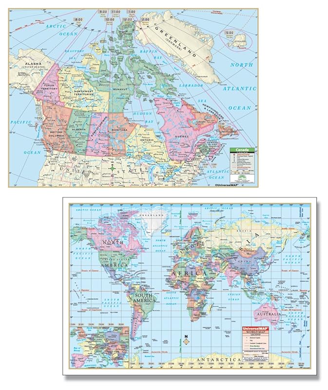
Canada Rolled Laminated Maps feature capitals and provincial boundaries. The World Rolled Map displays the Mercator projection and offers complete coverage, including an inset of Europe. Rolled Maps of Canada and the World are the perfect compliment for students of all ages. These full-color images are the same clear, concise maps seen in the notebook map and deskpad map for easy cross-referencing.